A Trip Down the Arroyo Seco: A Microcosm of the Relationship between Technology, Nature, and Society Part II
– By Tonatiuh Rodriguez- Nikl
Introduction
In the first part of this trip we joined the Arroyo Seco far above the LA Basin, following it from its (mostly) natural state into civilization, where it was quickly harnessed for flood control into a concrete channel. We observed that the Arroyo reflects a relationship between humans and nature based on notions of control and certainty. In this second segment we continue the journey with a focus on the socioeconomic relations exposed along the Arroyo’s path.
The Lower Arroyo
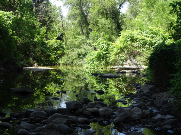
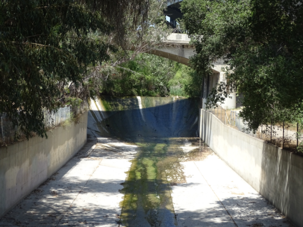
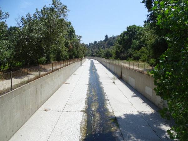
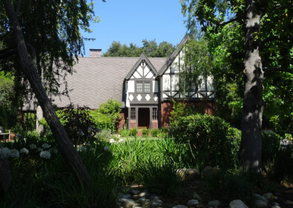
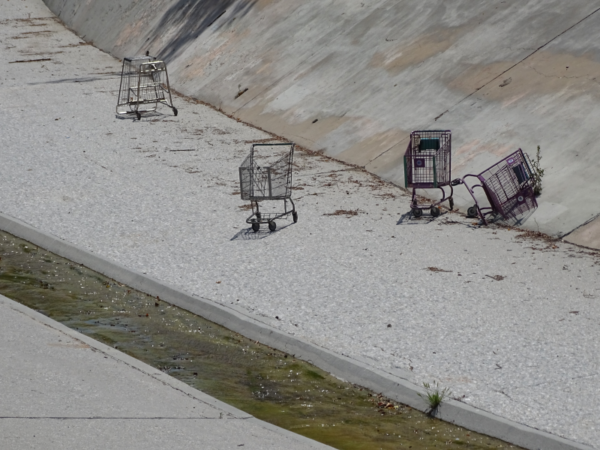
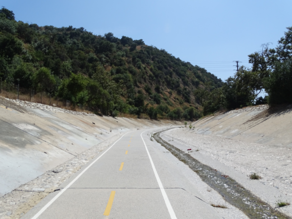
After leaving the Rose Bowl, the Arroyo spreads its banks one last time before it enters a channel on its way to the Los Angeles River. In this section, the channelized river runs through a narrow recreational corridor with beautiful homes scattering its upper slopes. How did even affluent residents end up with this ugly, fenced, concrete channel dominating over two narrow walking paths?
It didn’t have to end up this way. In his book, Ecology of Fear, Mike Davis portrays the competing flood control proposals in the 1930s. On one side of the debate
[Urban designers] Olmsted and Bartholomew emphasized … that flood control could be accomplished by different combinations of landuse planning and public works. Their preference was to strictly limit private encroachment within the 50-year floodplain. They wanted to conserve broad natural channels in which storm waters could spread, irrigating and fertilizing the riverside landscapes that out of flood season would serve the public as nature preserves, recreational parks, and scenic parkways.
On the winning side of the debate, the proposed solution was
… to deepen and “armor” -that is, pave- a narrow width of the river’s channel in order to flush storm runoff out of the city as efficiently as possible, and thus allow extensive industrial development within the floodplain. Beneficial to large landowners, this strategy would force the natural river into a concrete straitjacket – destroying the riparian ecology and precluding use of the riverway as a greenbelt.
Thus, the channelized Arroyo isn’t just a waterway but a physical instantiation of a decades-old power grab by industry and large landowners, forces much stronger than the typical affluent homeowner.
Towards the Confluence
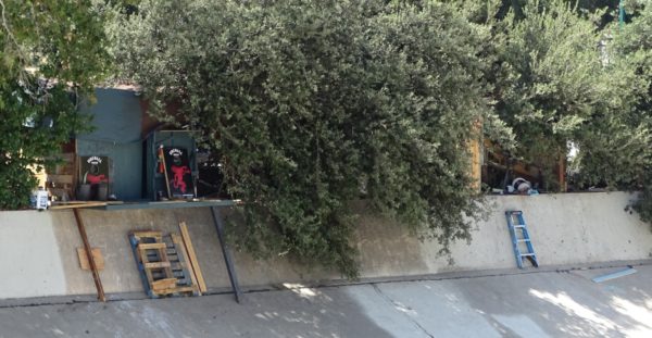
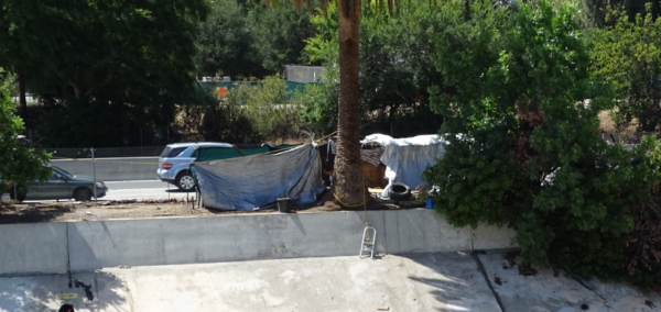
As we continue, we pass briefly through the upscale city of South Pasadena, passing horse stables, a large public park, a racquet club, and a golf course. After this we cross into the City of Los Angeles. The influence of municipal boundaries could not be starker. Here, as the bike path drops into the channelized river, homeless encampments sprout up on the riverbank in a small stretch of land between the Arroyo and the freeway. What is usually hidden from the safety and comfort of an enclosed car becomes unavoidable from the vantage point of the Arroyo. The channelized Arroyo is no longer a place for recreation but a place to hide the Other: homeless residents and to a lesser extent urban bike riders. Even the Arroyo has become the adjoining freeway’s Other. By and large, the Arroyo maintains this otherizing character as it flows into the Los Angeles River and eventually the Pacific Ocean.
Conclusion
After seven and a half hours on (and off and on and off) the bike, it was time to turn home. In Part I of our trip, we reflected on a relationship between humans and nature based on notions of control and certainty. In Part II we observed wide disparities in living standards and the role the Arroyo’s channelization plays in concealing the Other. On top of this dynamic of difference and disparity is a layer in which powerful interests make decisions that affect all residents, current and future.
Had we continued downriver, the bike path would have soon ended. Following the river on city streets we would have soon arrived at “The Confluence” of the Arroyo Seco with the (in) famous LA River.
Video explaining the various layers of history related to this segment of the LA river (scroll left and right to follow the narrator)
Here we might have reflected on the “birthplace of Los Angeles,” so named because this is the spot where the Spaniards first decided to set up shop. We may have wondered how the place looked to the Spaniards: flush with vegetation instead of encased in concrete. We may have asked why we call it a “birthplace” if the Tong-Va people were already here? Around here we would have passed several sites envisioned for restoration with new habitat and recreation facilities. If the ambitions restoration plan ever comes to fruition (which is by no means assured) it will be a great improvement. We do have to wonder, however, whether it will replicate pre-existing urban battles, as did the new, iconic 6th street bridge just downriver from the confluence.
Had we continued further, we would have found another bike path that runs along the channel to the City of Long Beach, where the river water flows into the Pacific Ocean. Here we might have reflected one last time on another unintended consequence of the impermeable channel: eliminating the naturally occurring recharge of the groundwater in the Los Angeles basin.
Outro
Thanks for joining me on this trip. I hope that it has helped uncover some of the many layers of observation and interpretation that can be found in our urban infrastructure. If you live in Los Angeles, take a trip out to the river. Do you agree with my observations? What else do you notice? If you live far from Los Angeles, is there an iconic infrastructure project that you can substitute for the same purpose? If you want to get in touch with me, contact The Maintainers. They’ll know where to find me.